Best and Final Offer for Mako Gold Limited
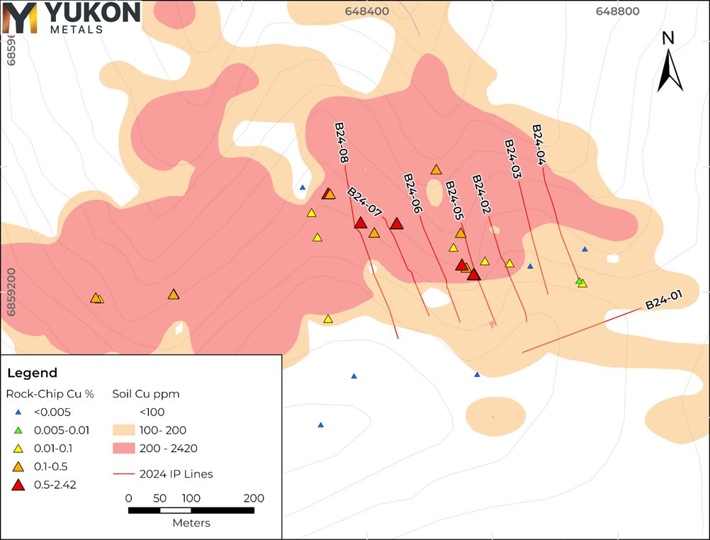
- Yukon Metals geologists completed eight ERT and IP geophysical surveys over the eastern portion of the 2024 soil sampled copper and gold anomaly at Birch. The survey identified several high-priority drill targets.
- Structural geological features can be inferred from the geo-electric signatures of the rock, guiding drill placement.
- The new geophysical data aligns with previously identified soil anomalies of up to 0.24% Cu in soils and up to 0.99 g/t Au spanning 1400 meters, and rock chip sampling with values up to 2.42% Cu and 14.1 g/t Au, further emphasizing the project’s potential for significant mineralization.
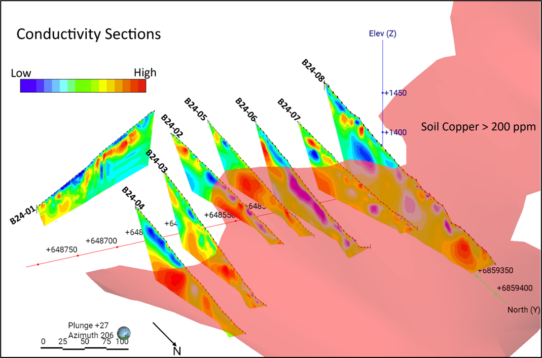
- All sections intersecting the soil anomaly zone showed geophysical anomalies below surface that are interpreted to correspond to changes in rock type and sulphide mineralization in skarn horizons over several hundred meters.
Rory Quinn, President & CEO stated, “With this geological survey program, which includes induced polarization, surface mapping, and soil and rock sampling programs, Yukon Metals is closer to uncovering the mineral potential of the highly prospective Birch Property. The next step will be to commence drilling at Birch, targeting mineralized skarn horizons .”
The survey identified several high-priority geophysical anomalies supporting the next phase of exploration. These results mark an important step forward in advancing Birch as a highly prospective property for precious and base metal mineralization. The geophysical data is being integrated with surface geochemical results, geological mapping, and previously collected airborne magnetic survey data, to define both high-priority drill targets, and areas for future exploration.
The ERT and IP surveys were conducted to study the electrical properties of the area’s dominant rock formations, including limestone, marble, schist, and granite. Structural geological features and contacts can be inferred from the geo-electric signatures of the rock, guiding drill placement.
These techniques involve sending electrical currents into the ground and measuring how different materials respond, creating detailed subsurface maps that highlight geological layers and structures. Induced polarization measures how certain materials, like metallic minerals, temporarily store and release electrical charge, often indicating the presence of sulfides. Conductivity indicates rock containing electrically conductive minerals such as sulphides and metallic elements. Resistivity is used to guide identification of rock type, delineate rock types, depth of overburden and identify anomalous zones.
Advanced software processed the data to produce high-resolution images, helping identify key geological features such as bedrock layers, mineralized zones, and areas of uncertainty.

Figure 1- 2024 Geophysics Lines with anomalous Copper in Soil and Rock Samples.

Figure 2- Conductivity sections with overlain 2024 copper-in-soil greater than 200 ppm. High conductivity zones (red) show a…
Read More: Best and Final Offer for Mako Gold Limited
